

To visit Needles history is to understand why the town is becoming a destination stop. At first glance, one sees the main street, which is on Highway 40, with a street mall effect. Stores line the highway and have everything any traveler may need for the continuation of her journey. However, when one travels a block off Highway 40, one sees the beautiful Colorado River and the intrigue of this area starts to grab hold of you.
Location
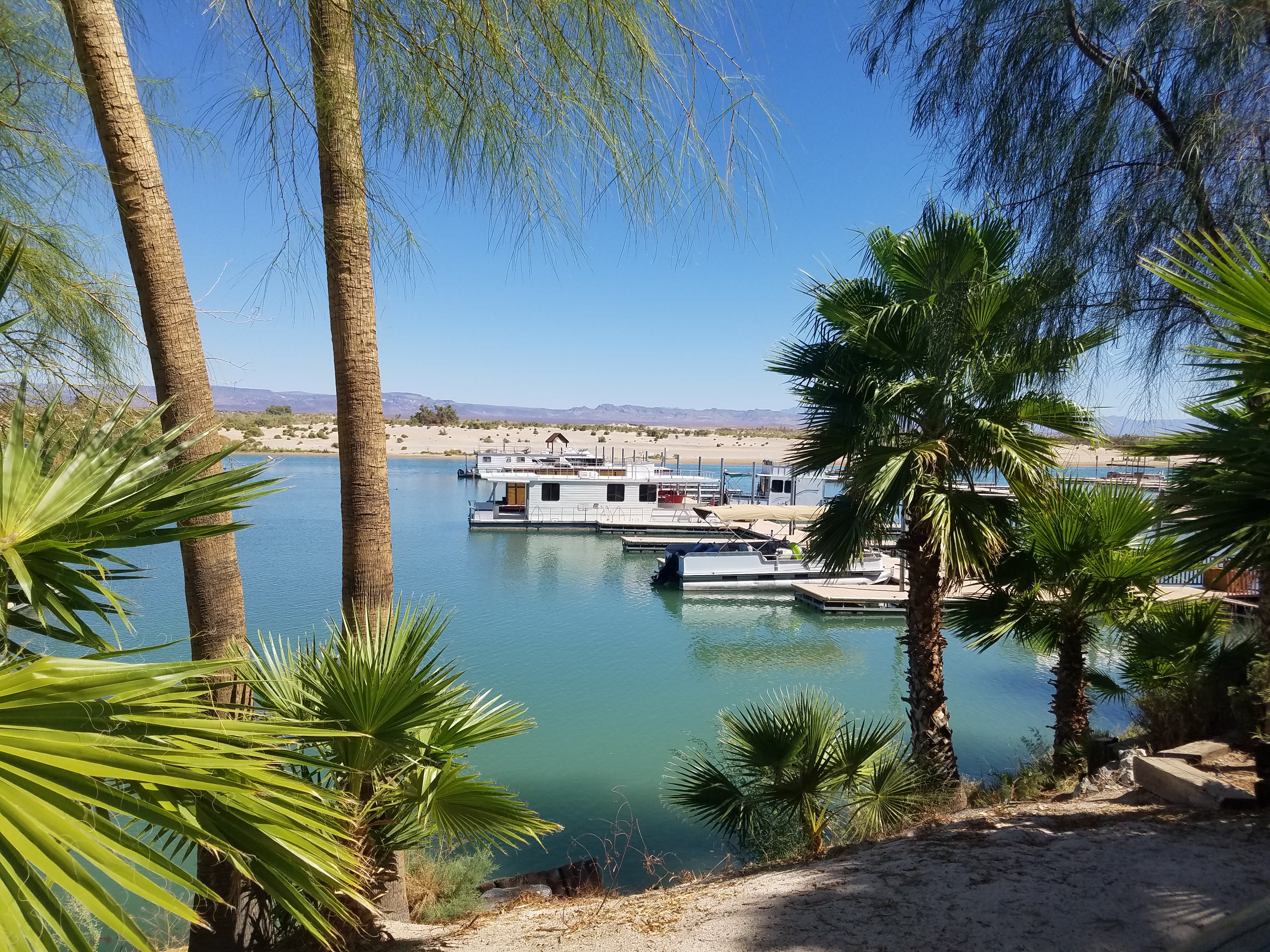
Colorado River.
Needles is the farthest East City in San Bernardino County California and located in the Mojave Desert with its boundary being the beautiful Colorado River. Across the river is the state of Arizona. On the horizon are the Mohave Mountain peaks in Topock which helped give Needles its name. Needles is a three-hour drive from Palm Springs and about one and a half hours from Las Vegas, making it a very doable two or three-day visit. One can spend a week if you decide to camp on the Colorado River in the many lovely RV mobile parks which are available with all amenities.
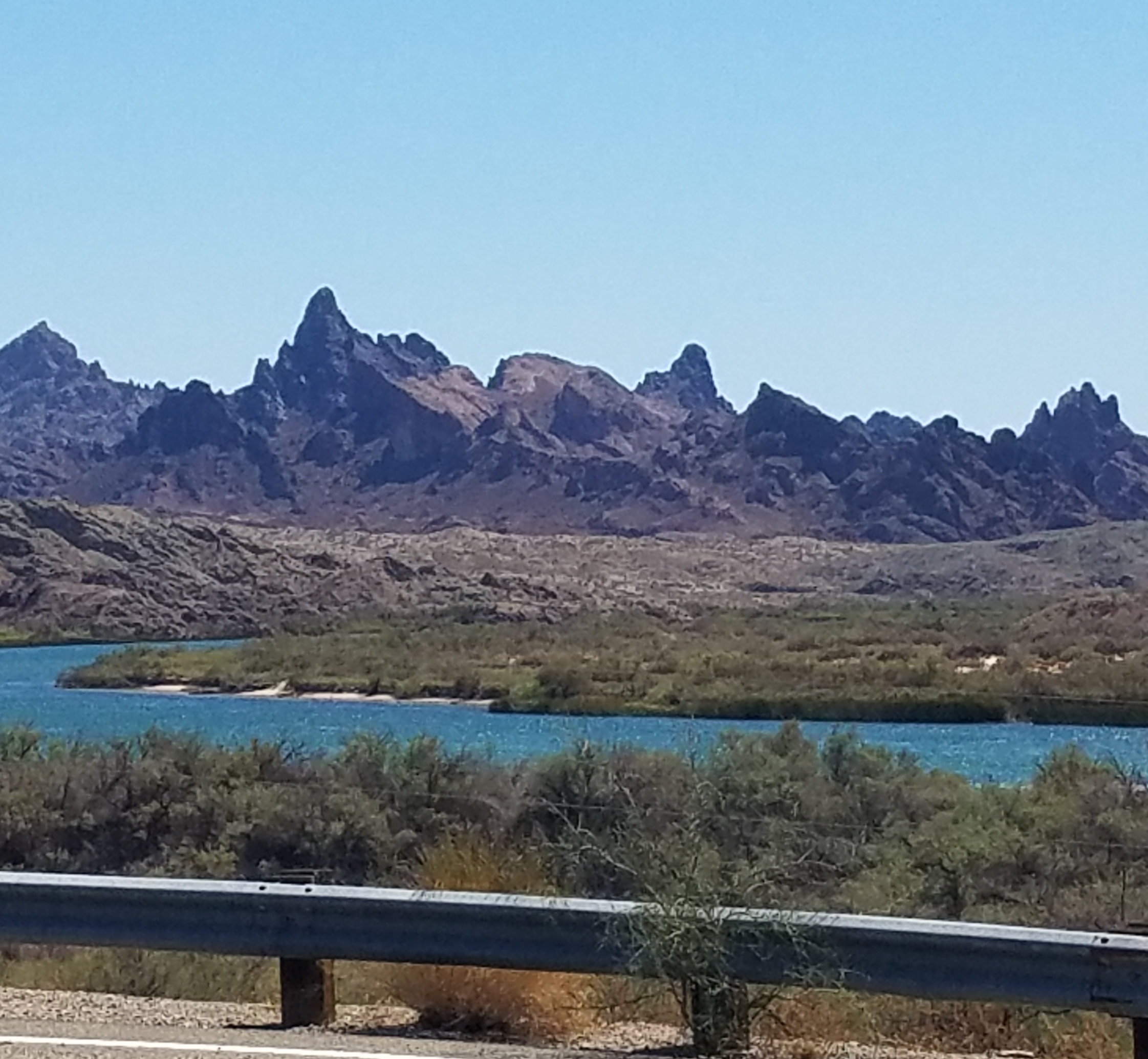
Mohave Mountain peaks.
History
Needles' formation began when three railroads, Atlantic and Pacific Railroad, Southern Pacific Railroad and the Santa Fe Railroad joined together to form the 35th Parallel Transcontinental Railroad. In 1883, Needles became the home of the railroad workers, who help build the railroad making coast-to-coast travel available to the newly developing West.
Workers were mainly Irish and Chinese immigrants though some of the laborers came from the United States. Once gold was discovered in the nearby Mohave Mountains, throngs of people headed west for surely they would be the ones to find that elusive pot of gold. Again, Needles' placement on the river provided easy access to supplies and shelter for a well-deserved respite from the harsh desert weather.
Needles Today
Route 66 has not lost its sense of intrigue. It starts outside of Chicago and ends at the Santa Monica Pier in Southern California.
While making the journey on Route 66, there was a need for facilities and supplies for much of the road is through the desolate Mojave Desert. Now, not unlike during the construction of the railroad, weary travelers are discovering Needles is the perfect place to relax and refresh. Let’s not forget, Needles is located on the Colorado River which flows south into the Sea of Cortez, in Northwestern Mexico.
A group of local citizens, realizing they were living in a town, which plays a significant role in United States’ history, took steps to preserve this history. A group of authors were in the process of developing a Route 66 Guide. It was to be called The Mother Road Route 66 Passport. When contacted, it was too late to get Needles into the Passport. However, after a little persuasion and new information, the authors agreed to include the town.
The Passport recently has been translated into eight languages. With the continuing effort of the local citizens and the outstanding support of the Discover Route 66, Needles is coming alive. Discover Route 66 routinely includes the leaders in discussions. People from all over the world are making Needles a stop as they explore the western United States.
Yes, Highway 40 was built and now is the center of town. However, ask any local, and they will be able to direct you on the actual Route 66 road which still exists along the river. Stop in at the Wagon Wheel Restaurant, which remains a local favorite. Want to stay overnight, in a motel, camp, or park your RV? Fender’s Road Resort can accommodate you. It is the only original motel still on Route 66 and the Colorado River.
The Mother Road Route 66 Passport can be purchased here.