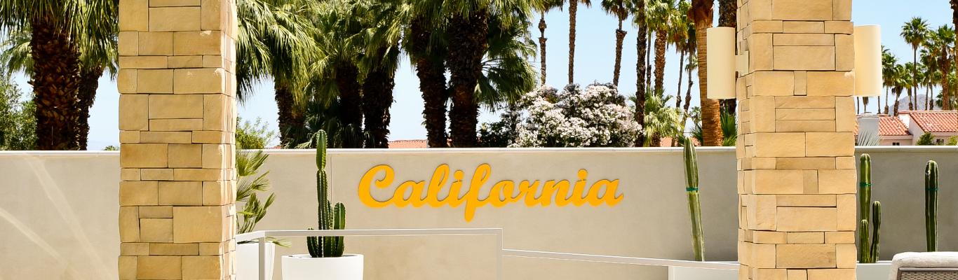


From Joshua tree forests to volcanic craters, the Mojave Desert is full of natural wonders. The Mojave National Preserve and Mojave Trails National Monument are both a three-hour drive from Greater Palm Springs, and they offer a handful of easy to moderate hiking trails that run right through these spectacular landscapes.
The Mojave is just as remote as it is beautiful, and visitors are advised to plan ahead and bring the appropriate gear to explore this rugged landscape. This includes plenty of water, extra food, warm clothing, a first aid kit, maps and a satellite communication device, as cell phone service is unreliable. While some roads in the Preserve and National Monument can be rough, the trails listed below are all on fairly well-maintained roads that do not require a four-wheel drive vehicle.
Rings Loop Trail (Mojave National Preserve)
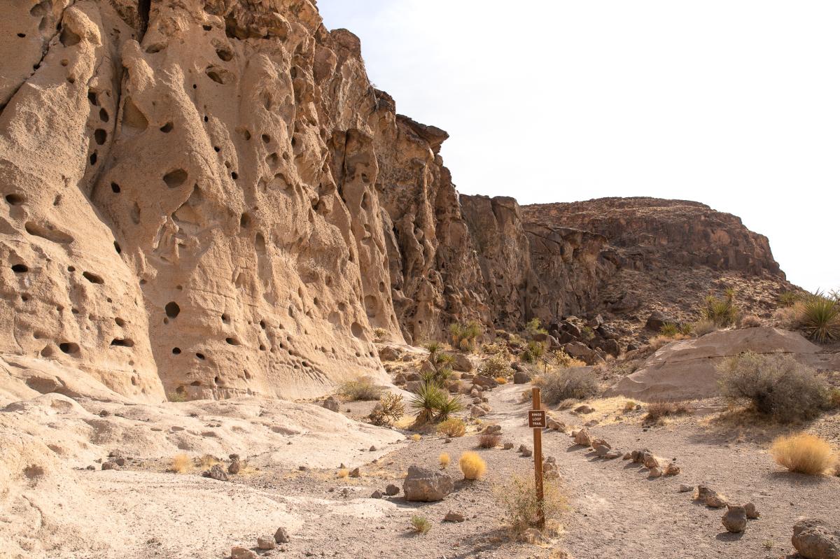
Fast facts: 1.3 miles total, 130 feet of elevation gain, free parking and day use
The Rings Loop Trail is a short and sweet hike that gets a bit spicy thanks to a brief scramble at the end. The trail runs through Banshee Canyon, which features volcanic rock formations filled with holes, hence the name of the adjacent Hole-in-the-Wall Information Center. If you start the trail clockwise from the lower parking lot at the Visitor Center (recommended), the first mile is flat and easy. From there, you’ll enter the canyon and climb up two sets of metal rings bolted to the canyon walls. No ropes or helmets are necessary, and these sections are about six feet tall. If you’re with a partner or young children, you can safely spot them or give them a leg up on this section of the hike. The trail ends at a parking area above the Information Center; simply walk a quarter-mile down the dirt road back to the lower parking lot. The road to the Hole-in-the-Wall Information Center is paved, though there are some rough spots and potholes along the way. Picnic tables and pit toilets are open at the Visitor Center.
Amboy Crater (Mojave Trails National Monument)
Fast facts: 4 miles total, 400 feet of elevation gain, free parking and day use
Amboy Crater, designated a National Natural Landmark in 1973, is an impressive geological feature visible from Route 66 and Amboy Road. A four-mile roundtrip trail takes hikers straight into the 6,000-year-old volcanic cinder cone, which is 250 feet high and 1,500 feet in diameter. The trail is flat, sandy and easy to follow for the first mile, and shortly after that you’ll begin to climb up the west side of the crater and into the caldera, and the terrain becomes a bit rockier. Three different spurs take you to the crater rim, which offers sweeping views of the Marble Mountains. The road to the Amboy Crater trailhead is paved, and picnic tables, pit toilets and an ADA overlook are next to the parking area. There are also several rest stations along the trail.
Kelso Dunes (Mojave National Preserve)
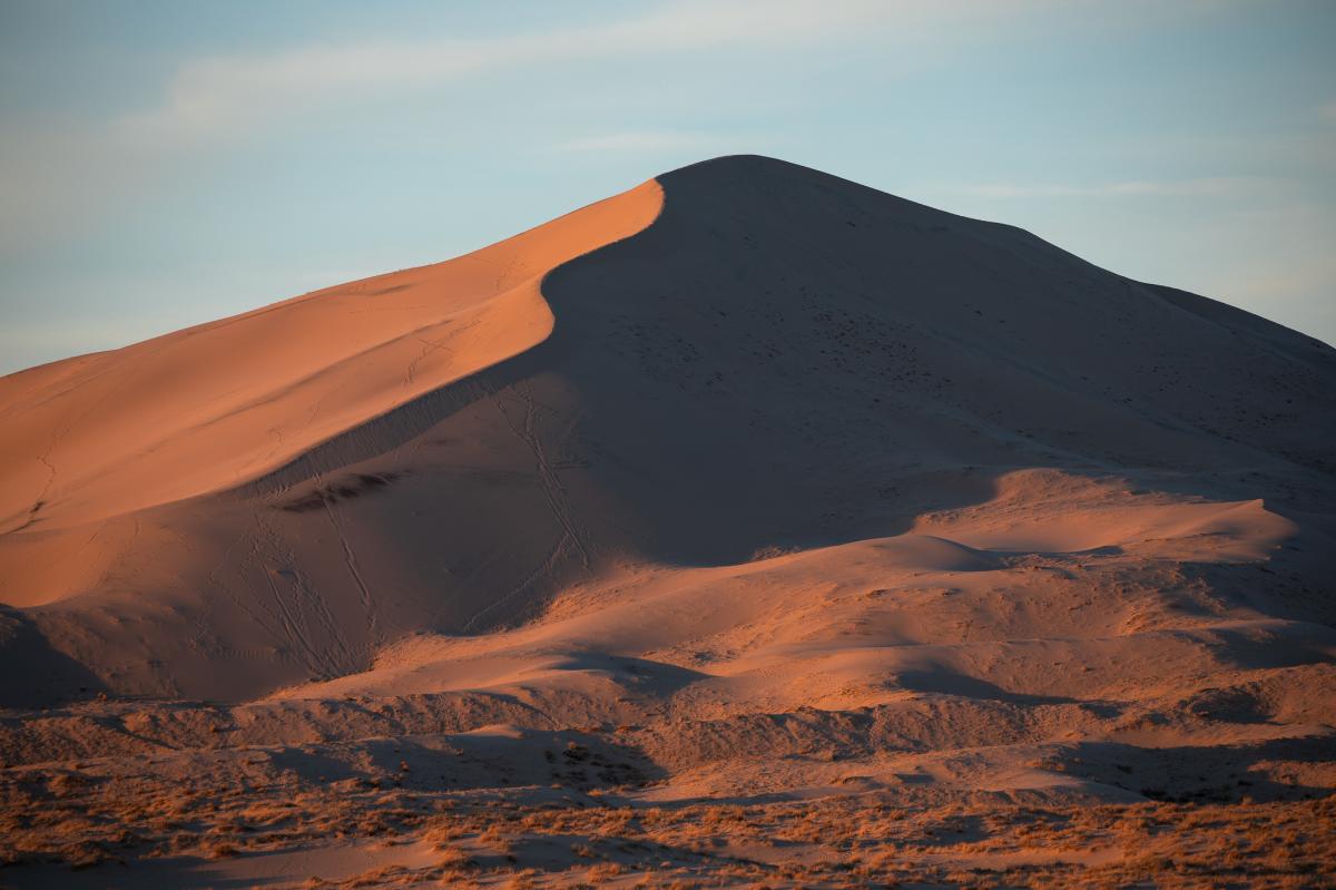
Fast facts: 3 miles total, 650 feet of elevation gain, free parking and day use
The Kelso Dunes cover 45 square miles in the Mojave Desert, with the tallest dune topping out at 650 feet. Per the National Park Service, these are one of seven known sand dune fields in North America that produce booming or “sand singing,” a low-frequency vibration that can be heard and felt. The trailhead is clearly marked, but after the first quarter of a mile, there is no trail: you simply choose your own adventure. Either way, you’ll hike about a mile on a mix of sand and desert scrub before arriving at the base of the dunes. From there, it’s another half of a mile with 350 feet of gain to the top of the two largest dunes. You can walk anywhere you want on the dunes, but these two make for the most popular photo ops. The three-mile drive down Kelso Dunes Dunes Road is a mix of pavement and dirt, but a 4x4 vehicle is not necessary. Restrooms and trash receptacles are available at the trailhead.
Lake Tuendae (Mojave National Preserve)

Fast facts: .25 miles total, flat, free parking and day use
The flat, quarter-mile loop trail around Lake Teundae isn’t exactly a hike, but it’s still worth a visit, especially if you’re traveling along Interstate 40 between Barstow and Baker. Formerly the Zzyzx Mineral Springs and Health Spa, this artificial pond is now home to the endangered Mojave tui chub fish and American coots, and it sits next to the California State University Desert Studies Center. Lake Teundae is open from sunrise to sunset, and the road to the designated visitor parking area is mostly paved and suitable for low-clearance vehicles. The structures next to Lake Tuendae are considered private property and part of the CSU Desert Studies Center. National Park Visitors are only permitted to walk on the path around Lake Tuendae; this is clearly marked from the moment you enter the visitor parking area.
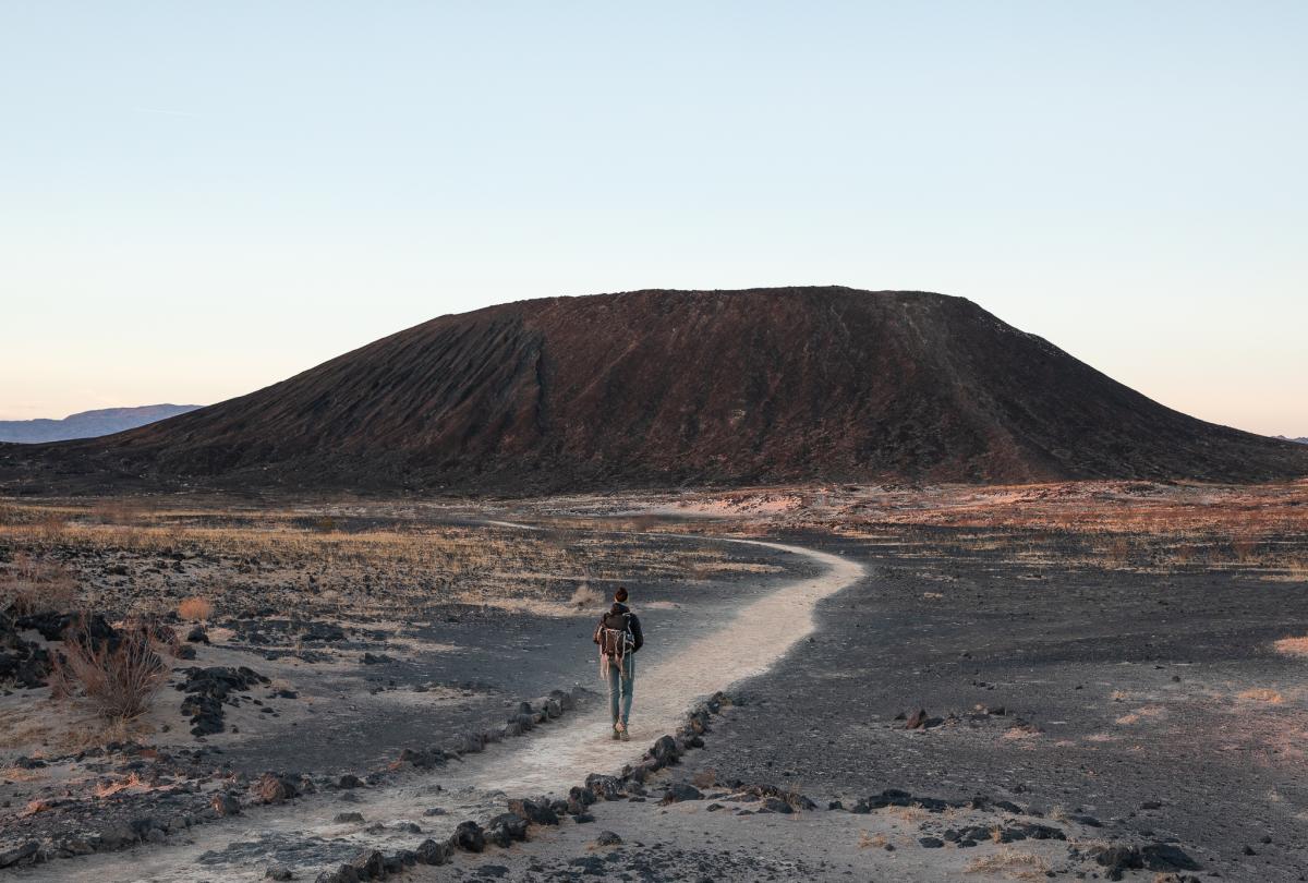
Lava Tube (Mojave National Preserve)
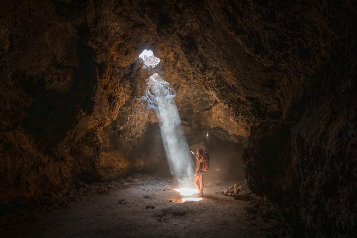
Fast facts: .5 miles total, 150 feet of elevation gain, free parking and day use
Another short hike with a unique photo op is the Lava Tube Trail, located on the northwest section of the Preserve near the Cinder Cone Natural Landmark. A flat, half-mile out-and-back trail leads to a metal stairway, and from there you descend into the lava tube. After squeezing through a section about three feet tall, the cave opens up. If you go in the mid-afternoon on a sunny day, you’ll see light beams poking through two holes on the ceiling of the lava tube. Headlamps are helpful, and you’ll want to watch your step, as there are some loose rocks in the cave. While getting into the lava tube is a fairly hassle-free adventure, the bumpy, five-mile ride down Aiken Mine Road is another matter. A high-clearance vehicle is recommended, as the road has everything from sand to sharp rocks.
Teutonia Peak (Mojave National Preserve)
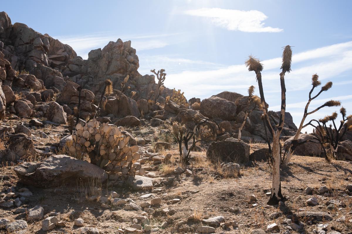
Fast facts: 3.2 miles total, 650 feet of elevation gain, free parking and day use
When the Dome Fire burned through the Mojave National Preserve in August of 2020, it scorched 43,273 acres, including most of the Teutonia Peak Trail. While the out-and-back trail is open and well-marked, the once spectacular Joshua Tree forest is now a graveyard of charred desert vegetation. A few patches of Joshua trees survived the blaze, but most look like the one in the photo above. The first mile of the trail is flat and well-marked, and the last half mile has approximately 500 feet of gain over somewhat rocky terrain. The trailhead parking area is right off of the paved Kelso Cima Road, and it has room for about five vehicles. There are no bathrooms or trash receptacles at the trailhead.
Mitchell Caverns (Providence Mountains State Recreation Area)
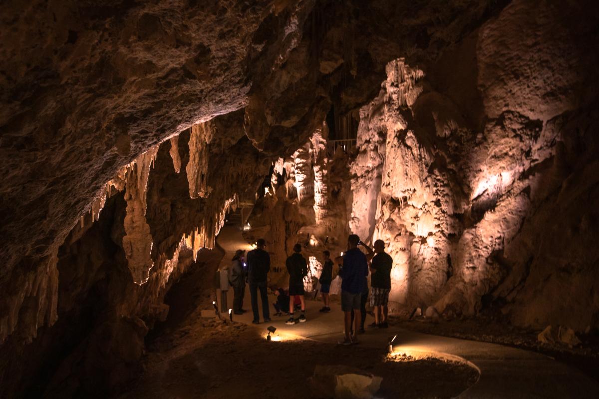
Fast facts: 1.5 miles, 150 feet of elevation gain, parking is $10 and tours are $10 for adults, reservations required
Located within the Mojave National Preserve, the Providence Mountains State Recreation Area is home to Mitchell Caverns, a network of stunning limestone cave formations. The one-and-a-half-hour guided tour includes a short hike to the cave entrance, and once inside, visitors will explore the El Pakiva and Tecopa caves via paved walkways and a handful of stairs. In addition to stalactites and stalagmites, cave shields and columns exist in this underground wonderland. The park is open Friday through Sunday (and holiday Mondays) from 8 a.m. to 5 p.m., but access to the caverns is available only via the guided tour. Reservations are made on Mondays only by calling the Providence Mountains SRA office at 760-928-2586 between the hours of 8 a.m. and 5 p.m. From October to May, there are daily tours at 11 a.m. and 2 p.m., and from June to September, just only daily tour runs at 10 a.m. Parking is $10, and tours cost $10 for adults, $9 for seniors and $5 per child. The road to the Providence Mountains SRA Visitor Center is paved, and restrooms are located at the lower parking lot.