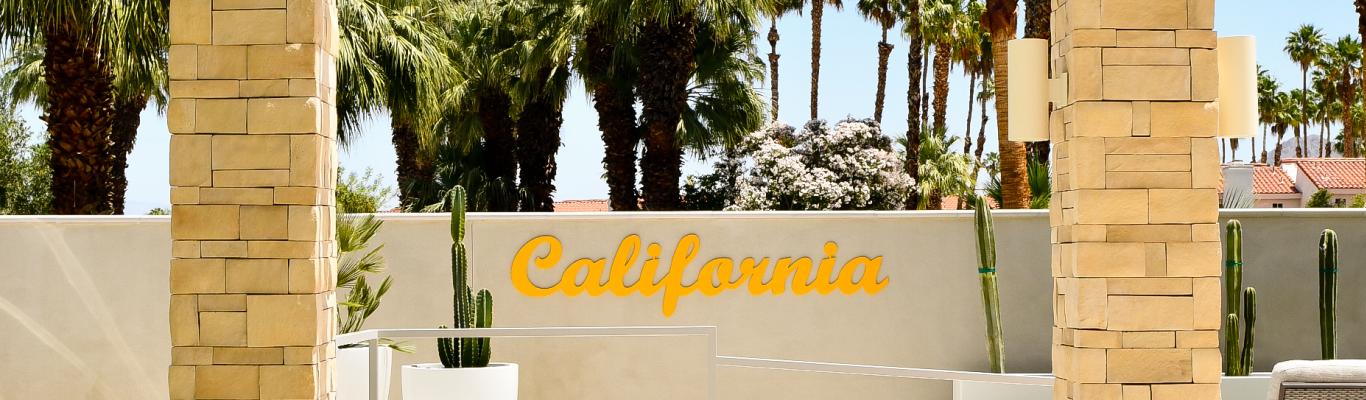


From sparkling sand dunes to spectacular palm oases, California’s deserts are home to countless natural wonders that inspire the artistic eye. These are some of the most incredible places for nature photographers in Death Valley National Park, Joshua Tree National Park, Anza-Borrego Desert State Park, the Mojave National Preserve and more, with notes on road conditions and resources for camping and lodging.
Please remember to plan ahead and be a respectful visitor when exploring parks and public lands. Check park websites or call local ranger stations for updates on road conditions and closures, and bring extra water, food and clothing. When traveling in California’s vast deserts, consider bringing a satellite communication device, as many of these areas do not have reliable cell phone service. Stay on established roads and trails, pack out your trash, and be mindful of restrictions regarding campfires. If you are unfamiliar with responsible recreation practices, check out these travel tips, or visit the Leave No Trace website to learn more.
Death Valley National Park
Death Valley National Park is a land of extremes, and whether it’s your first time visiting or your tenth, there are endless opportunities for exploration. Covering over 3 million acres, Death Valley is the largest national park in the lower 48 states, and with nearly a dozen campgrounds and hotels in and around the park, there are plenty of lodging options. Due to significant damage from 2023’s Hurricane Hilary, a handful of roads in the park are still closed. For the latest updates and information on closures, please visit the Death Valley National Park website, or call one of the park’s two ranger stations. Park entry is $30 per vehicle, or free for annual America the Beautiful pass holders.
Mesquite Flat Sand Dunes
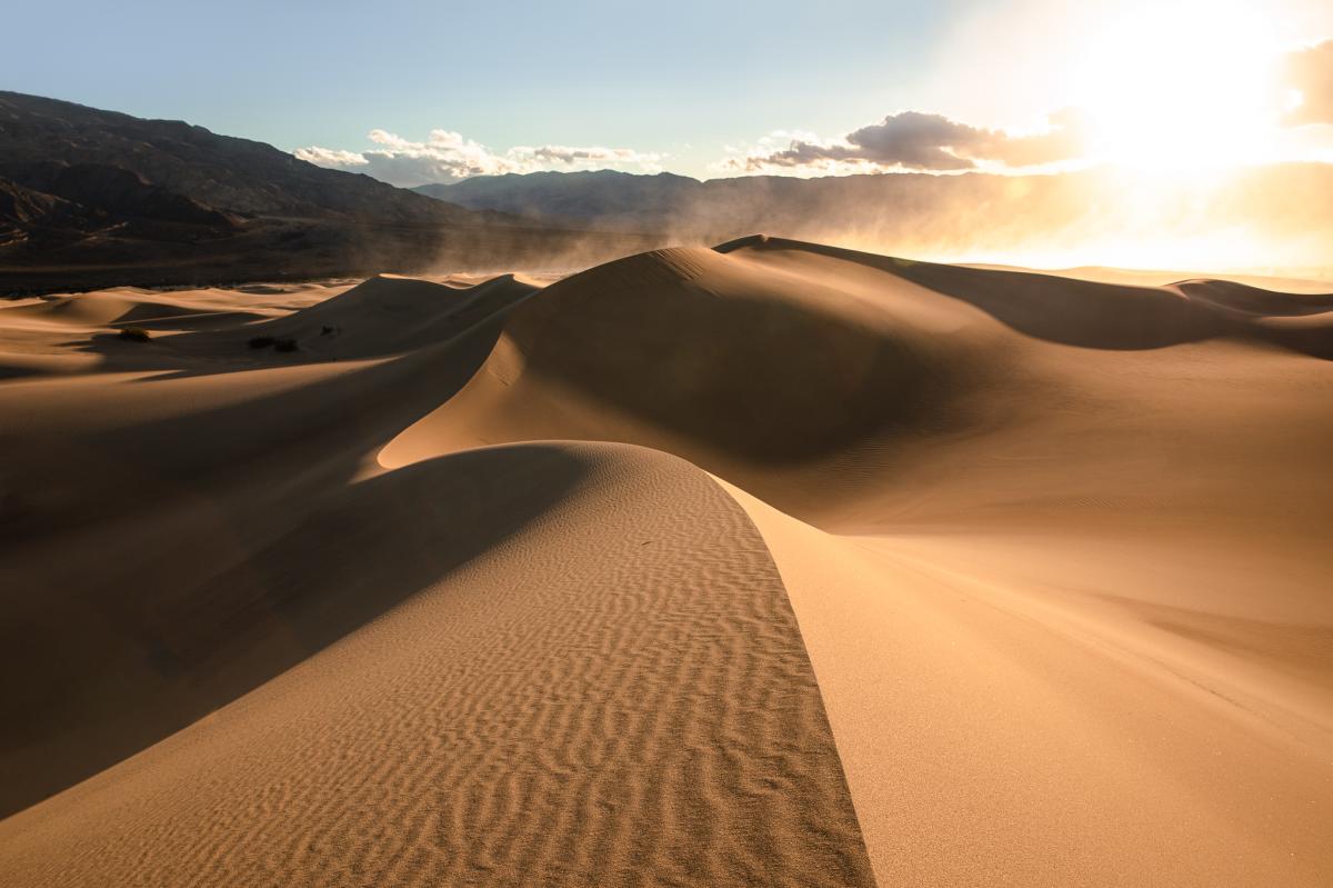
Located two miles past Stovepipe Wells on California State Route 190, the Mesquite Flat Sand Dunes are a visitor favorite — and the most accessible dunes in the park. Bordered to the northwest by the Grapevine Mountains, the Mesquite dunes are striking at almost any time of day, but they are especially magical in the early morning light. If you’re seeking untouched dunes, be prepared to walk around three miles in the sand, or visit right after a wind storm.
Badwater Basin
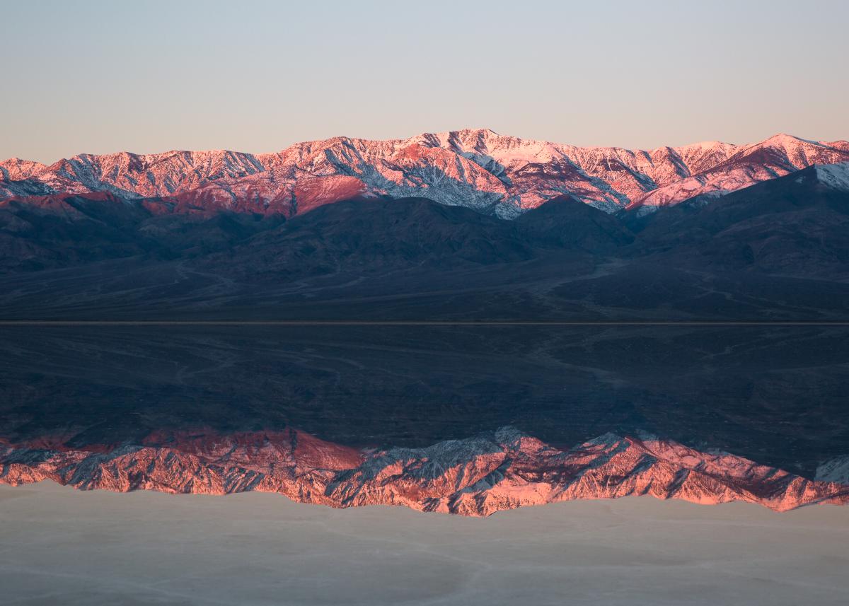
Badwater Basin holds the distinction of being the lowest point in North America, sitting at 282 feet below sea level. The vast salt flats meet the base of the Panamint Mountains, and from wide landscape shots to close-ups of crystalline salt tiles, there are all kinds of photo ops. As of January 2024, there is still a significant amount of water on the salt flats from 2023’s Hurricane Hilary, which makes for incredible reflections, and a once-in-a-lifetime chance to see a lake in the basin.
Joshua Tree National Park
Joshua Tree National Park marks the border between the Mojave and Colorado deserts, and it is recognized as an International Dark Sky Park thanks to its exceptional stargazing. The park is celebrated for its unique geology, and a drive along the north end of Park Boulevard rewards visitors with views of rock formations and forests of Joshua trees. In addition to eight campgrounds in the park, there is lodging (plus fuel and food) in Joshua Tree and nearby 29 Palms. Park entry is $30 per vehicle, or free for annual America the Beautiful pass holders.
Cholla Cactus Garden
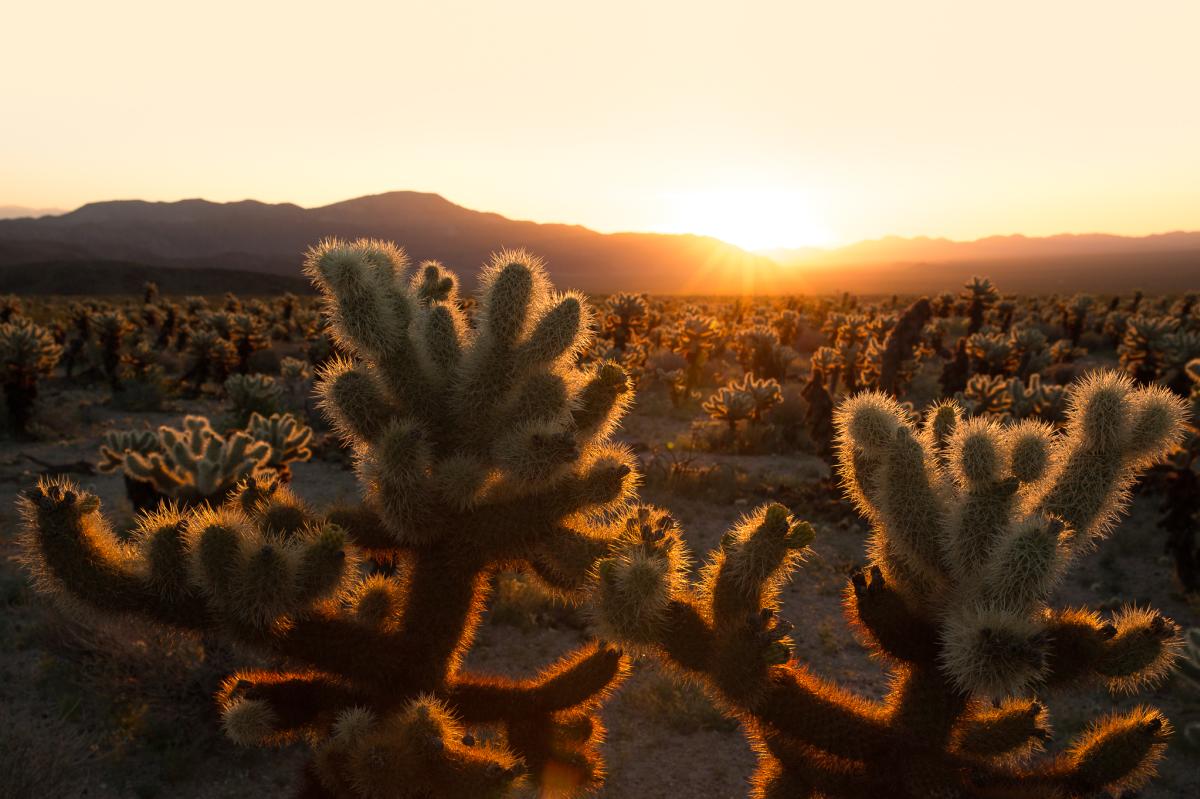
The Cholla Cactus Garden has a dense concentration of teddybear cholla cacti, which are also known as "jumping" cholla. Per the NPS website, segments can break off of the cactus and attach to people and animals as a way to reproduce, so be sure to watch your step along this quarter-mile trail. Sunrise at the Cholla Cactus Garden is a favorite time of day for photographers, as the backlighting on the spines of the cholla glow in the early morning light.
Oasis of Mara
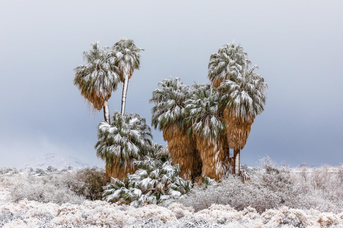
The Oasis of Mara is a historical and ecological treasure, offering a stark contrast to the surrounding desert. The region was originally settled by the Serrano people, who reportedly planted 29 palm trees to represent the number of sons born during the first year they lived at the Oasis. This also explains the name of the city of 29 Palms, where the Oasis and Joshua Tree National Park headquarters are located. The photo above was taken during a rare winter storm; while snow is not common in and around the park, it can happen a few times each year.
Mojave National Preserve
The Mojave National Preserve spans over 1.5 million acres, and with wide variety of desert landscapes, it is a photographer’s paradise. The Preserve sits between Interstate 15 and Interstate 40, and while most major roads in the park are open, as of January 2024, part of Cima Road is still closed, along with several primitive dirt roads, and the restrooms at Kelso Depot. Please check the Mojave National Preserve website for the latest updates and information on road conditions and closures. There are two main developed campgrounds in the park, and dispersed camping is allowed as well. Day use is free.
Kelso Dunes
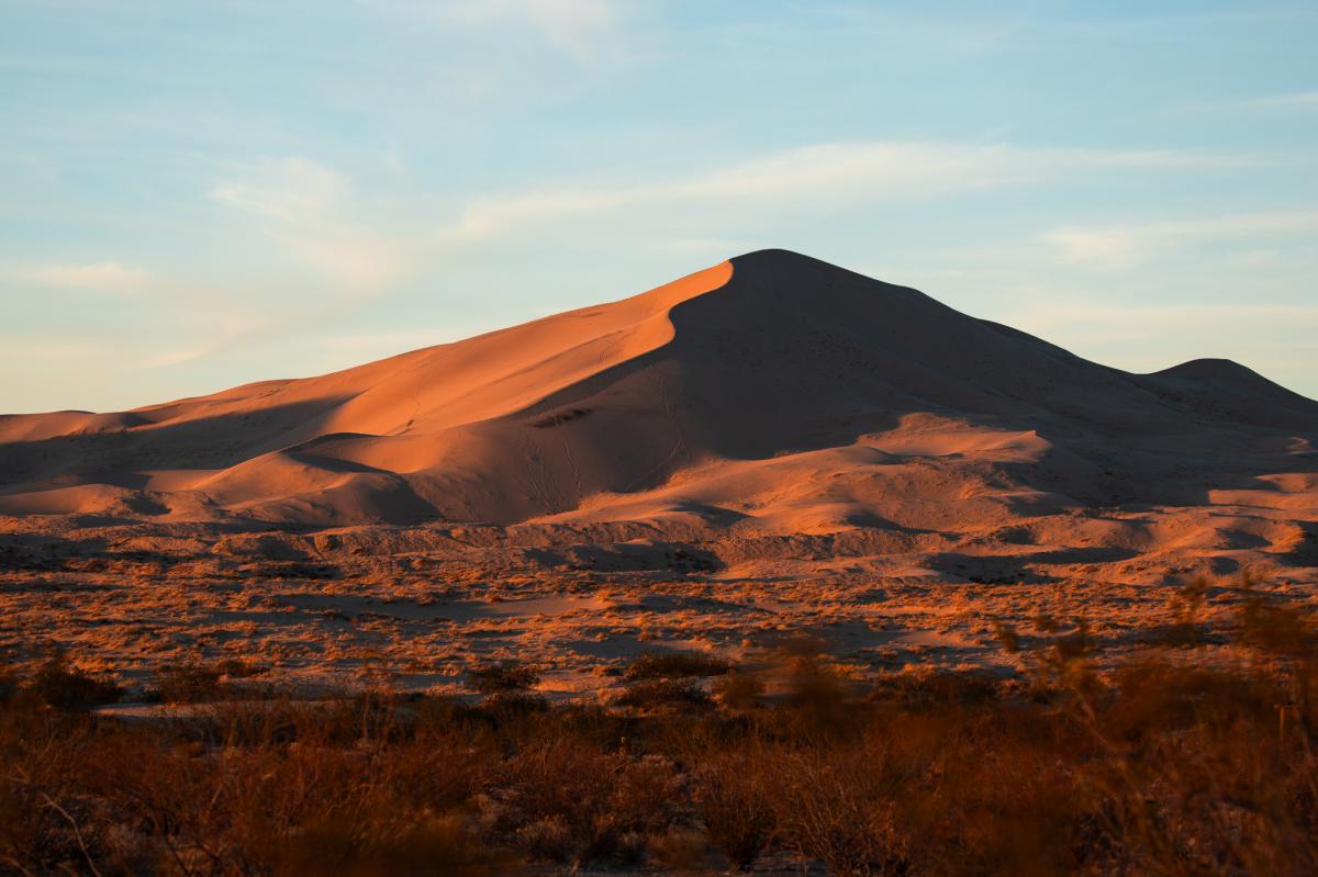
The Kelso Dunes are the largest in the Mojave, covering 45 square miles and reaching heights of up to 650 feet. These are one of seven known sand dune fields in North America that produce booming or “sand singing,” a low-frequency vibration that can be heard and felt when the sand slides down the dune surfaces. The three-mile drive on Kelso Dunes Road is a mix of pavement and dirt, but a 4x4 vehicle is not necessary. Restrooms and trash receptacles are available at the trailhead.
Cinder Cone National Natural Landmark
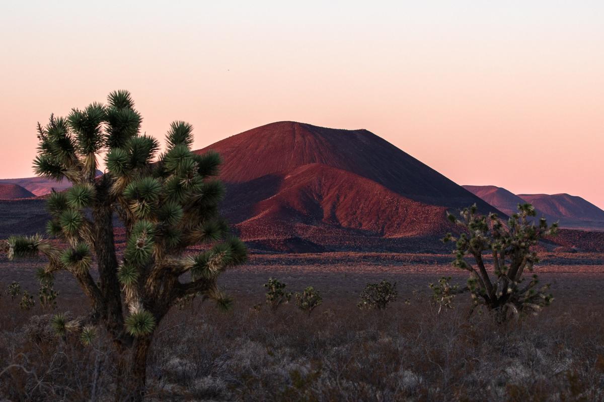
If you head south into the Preserve from Baker on Kelbaker Road, you will spot a large cluster of cinder cones to the east. The volcanic field, which was designated the Cinder Cone National Natural Landmark in 1973, covers a surface area of approximately 230 square miles, and consists of 32 conical mounds.
Anza-Borrego Desert State Park
With over 640,000 acres and 12 wilderness areas, Anza-Borrego Desert State Park is California’s largest state park. The park is renowned for its spectacular wildflower blooms and a rich array of wildlife, including Peninsular bighorn sheep and more than 70 species of reptiles and amphibians. The closest town with services is Borrego Springs, which has fuel, food and lodging. There are two main developed campgrounds in the park, which are reservable online, and dispersed camping is allowed as well. Day use is $10 per vehicle or free for annual California State Parks pass holders. Please check the Anza-Borrego Desert State Park website for the latest updates and information on road conditions and closures, as many primitive roads in the park require 4x4 vehicles.
Clark Dry Lake
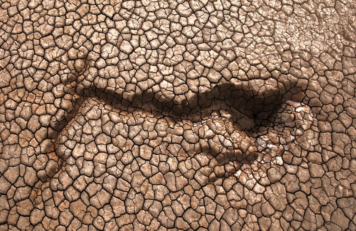
Once covered in water, Clark Dry Lake is now a vast expanse of cracked clay. The area was used as an airfield during WWII by the United States Navy, complete with two runways and a bombing range. Clark Dry Lake is accessible from Rockhouse Trail Road, but a 4x4 vehicle is strongly recommended, as the dirt road is not maintained.
Font's Point
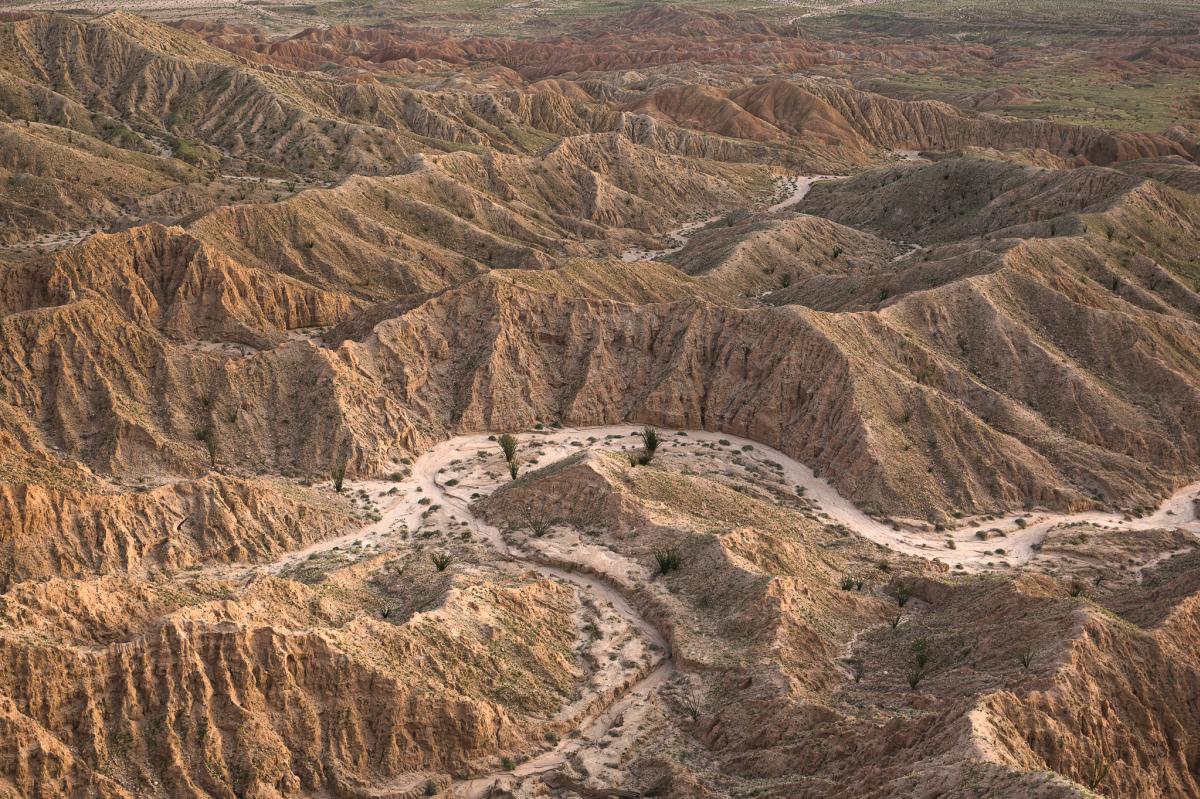
Font’s Point offers a stunning panoramic view of the park's badlands, showcasing intricate erosion patterns and layers of sedimentary formations. The turn for Font’s Point is on County Road S22, near mile marker 29, or approximately three-and-a-half miles east of the intersection with S22 and Henderson Canyon Road. A 4x4 vehicle is strongly recommended, as much of the four-mile dirt road to Font’s Point is in a wash with deep sand.
Trona Pinnacles
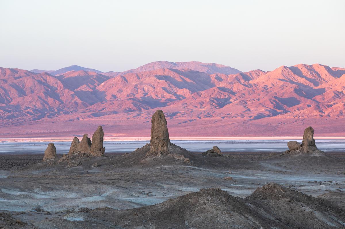
In 1968 the Trona Pinnacles were designated a National Natural Landmark, and they are one of the best examples of tufa formations in North America. The limestone towers were formed between 10,000 and 100,000 years ago during the Pleistocene Era, when the Searles Lake Basin was still underwater. With over 500 tufa spires, some of which stand as tall as 140 feet, these pinnacles are the definition of an otherworldly landscape. Though a four-wheel drive vehicle is not necessary to access the Trona Pinnacles, the road is rough and washboarded, and it may be impassable after a storm. The Trona Pinnacles are a 40-minute drive from Ridgecrest, which has lodging, dining and gas stations. Day use is free, and dispersed camping is allowed.
Salton Sea State Recreation Area
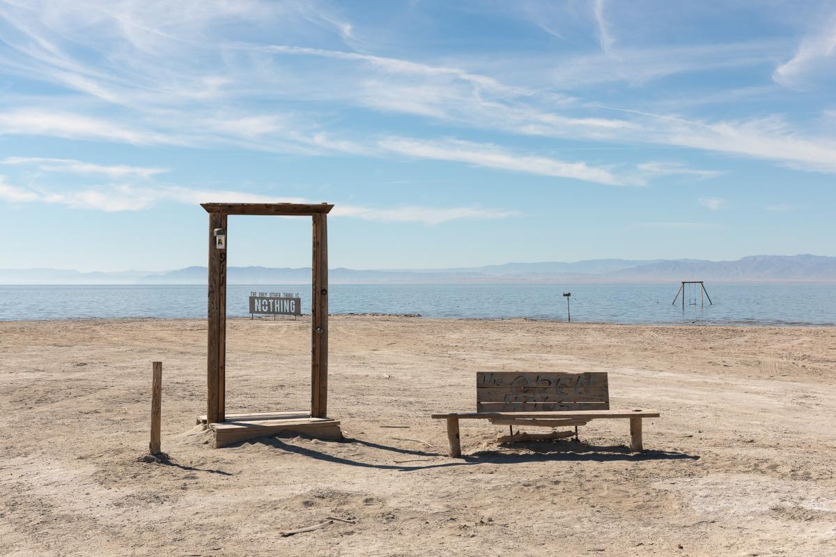
Located 60 miles southeast of Greater Palm Springs, the Salton Sea was formed in 1905 due to a breach in irrigation canals on the Colorado River. The saline lake became a popular resort town in the 1950s, but within two decades, most businesses and residents had left. With no natural outflow, the accidental lake saw an increase in salinity and pollution, and water levels have steadily declined over the years. In 2003 the California legislature passed the Salton Sea Restoration Act, and the Salton Sea State Recreation Area currently covers 14 miles of the northeastern shore, featuring campgrounds and trails.
While the Salton Sea serves as a poignant reminder of changes in the environment, over the years a vibrant arts community has emerged in the area. Each January, the Bombay Beach Biennale offers everything from workshops to film screenings, with an annual celebration in the early spring. Bombay Beach, pictured above, also has art installations year-round, many of which make for unique and captivating photo ops, with commentary on the history and ecology of the region. Bombay Beach is free and open to the public; day use at the Salton Sea State Recreation Area is $7 per vehicle, or free for annual California State Parks pass holders.